Where Is Mexico Located? Map, Borders and Geography
Locate Mexico in North America and understand its borders, seas, mountains, coasts and major physical regions.
Where Is Mexico Located? Map, Borders and Geography
MEXICO EXPLAINED / ORIGINAL US-ENGLISH GUIDE
Mexico is in southern North America. It is south of the United States and north and west of Guatemala and Belize. The country connects a large continental landmass with two major peninsulas and has coastlines on the Pacific, Gulf of Mexico, and Caribbean waters.
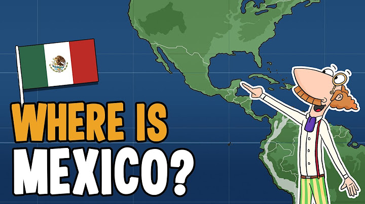
Borders and the correct regional label
The northern international boundary is with the United States. Mexico meets Guatemala and Belize along its southern and southeastern land boundaries. Geographically, Mexico is part of North America. The term Latin America refers to a different cultural and linguistic grouping, so the two classifications are not mutually exclusive.
Mexico is sometimes described as linking North America and Central America. It is clearer to say the country lies in North America and borders the Central American countries of Guatemala and Belize than to assume Mexico itself belongs to the usual narrow definition of Central America.
Which waters surround Mexico?
The Pacific Ocean borders much of Mexico’s western and southern coastline. To the east, the Gulf of Mexico borders states such as Tamaulipas, Veracruz, and Campeche. The northeastern side of the Yucatán Peninsula and nearby coast face Caribbean waters. The Baja California peninsula separates the Pacific Ocean from the Gulf of California.
A map that focuses only on the Yucatán resorts can hide how far Cabo San Lucas, near the southern tip of Baja California Sur, is from Cancún on the Caribbean side.
Mountains, plateaus and climate zones
Large mountain systems, including the Sierra Madre Occidental and Sierra Madre Oriental, shape rainfall and settlement. A volcanic belt runs across parts of central Mexico, while high plateaus include major cities well above sea level. In contrast, lowland coasts can be hot and humid, with different seasonal rainfall patterns.
It is a mistake to assume one national forecast applies everywhere. A traveler can encounter cool evenings in the highlands and tropical conditions on the Caribbean coast during the same week. Choose clothing and transportation plans by region and elevation.
How to read a Mexico map
Begin with the international borders, then locate the two peninsulas and the national capital. Next identify the relevant state and the route between destinations. For administrative maps, count 31 states plus Mexico City rather than claiming 32 states. For a road journey, use up-to-date route and safety guidance in addition to the map: straight-line proximity is not a reliable measure of road conditions.
A sample multi-region geography itinerary
Consider three destinations: Mexico City in the highlands, Cabo San Lucas on the Pacific-side Baja peninsula, and Tulum near the Caribbean coast. These locations illustrate different elevations, coastal systems, and transport needs. A simple “Mexico weather” forecast cannot describe all three accurately.
The same principle applies to maps of the border. The United States–Mexico boundary is long and passes through varied terrain; a road map helps with access, but it does not replace current advisories and travel conditions. Distances shown as straight lines can disguise mountains, water crossings, and permitted routes.
When teaching the country’s location, label the United States, Guatemala, Belize, the Pacific Ocean, and the Gulf of Mexico before adding internal state names. This order helps a reader find Mexico in relation to its neighbors.
Frequently asked questions
Which continent is Mexico in? North America.
Does Mexico border the Caribbean? Yes, particularly around the northeastern Yucatán Peninsula.
Which countries border Mexico? The United States, Guatemala, and Belize.
Continue exploring Mexico
Is Mexico a Country? A Clear Guide to the Nation • Map of Mexico’s 31 States and Mexico City • What Are Mexico’s Major Natural Resources?