Map of Mexico’s 31 States and Mexico City
Understand Mexico’s 31 states and Mexico City federal entity, with a map-reading guide and authoritative administrative references.
Map of Mexico’s 31 States and Mexico City
MEXICO EXPLAINED / ORIGINAL US-ENGLISH GUIDE
A political map of Mexico should show 32 federal entities: 31 states and Mexico City. It should not label Mexico City as a thirty-second state. The outline is only half the job; accurate names, boundaries, and a clearly dated source are essential.
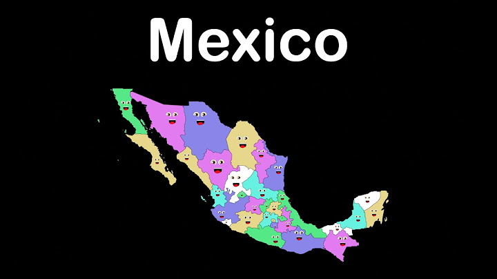
The 32 federal entities in an accurate state map
The complete list is Aguascalientes, Baja California, Baja California Sur, Campeche, Chiapas, Chihuahua, Coahuila, Colima, Durango, Guanajuato, Guerrero, Hidalgo, Jalisco, México (Estado de México), Michoacán, Morelos, Nayarit, Nuevo León, Oaxaca, Puebla, Querétaro, Quintana Roo, San Luis Potosí, Sinaloa, Sonora, Tabasco, Tamaulipas, Tlaxcala, Veracruz, Yucatán, Zacatecas, and Ciudad de México.
Administrative spellings sometimes include longer formal names, but the names above are recognizable on common geographic maps. A map caption should state the data edition and separate the administrative count from the number of states.
Why Mexico City is special
Ciudad de México is the national capital and a federal entity with a separate constitutional arrangement. The surrounding Estado de México is an actual state; confusing those two leads to misleading regional statistics, travel advice, and labels. New Mexico is a U.S. state outside Mexico entirely.
For a school report, the sentence “Mexico has 31 states and Mexico City” is a useful way to avoid this mix-up. Geographic data platforms may call the full set “32 federal entities” rather than “states.”
| Map label | Correct interpretation |
| Ciudad de México | Capital federal entity |
| Estado de México | One of 31 states |
| Baja California Sur | Cabo area on southern peninsula |
| Baja California | Tijuana area on northern peninsula |
| Quintana Roo | Cancún, Tulum and Cozumel state |
A practical way to read an unlabeled map
Locate Baja California and Baja California Sur on the long Pacific peninsula; identify the Yucatán Peninsula on the east; find Jalisco on the central Pacific side; identify Nuevo León in the northeast and Oaxaca in the south. Then find Mexico City in the highlands rather than on either coast.
For traveler use, remember that a change of state can mean a different official security advisory. The map helps you know which state’s guidance to read, but it does not replace that guidance.
Map asset requirements before publishing
This draft intentionally does not embed an unverified map. Before publishing a map-first article, add an accurate, accessible image you created or have permission to reuse; include alt text, readable state labels, a license record, and a clear geographic source such as INEGI. Without a real map, the page does not fully satisfy its primary visual intent.
Prepublication map accuracy checklist
A suitable geographic image needs legible boundaries between the peninsula states, a separate visible label for CDMX, and a correct outline for Estado de México. Check that Quintana Roo appears on the Caribbean side of the Yucatán Peninsula and that Nuevo León is not misplaced on the Pacific coast. Every abbreviation should be explained in the legend.
If your site displays a map thumbnail on the homepage, test it at small screen sizes. Readers should still recognize the country outline and know that the full page contains a readable, labeled version. An unlabeled thumbnail alone is not enough for a “map of Mexico states” query.
The asset should identify its source edition, usage rights, and alt text. Do not imply a generated diagram is an authoritative administrative boundary map unless its geometry was actually checked against official geographic data.
Frequently asked questions
How many states are there in Mexico? 31 states, plus Mexico City as an additional federal entity.
Is Baja California Sur the same state as Baja California? No. They are two separate states.
Where is CDMX on a state map? In central Mexico as its own federal entity, beside Estado de México.
Continue exploring Mexico
Is Mexico a Country? A Clear Guide to the Nation • Where Is Mexico Located? Map, Borders and Geography • What Happened to Mexico’s Federal District (DF)?