Native Land Map: Traditional Territories and How to Read It
Explore Native Land maps of Indigenous territories and languages, historical context, and the vital caveat that these are not official legal boundaries.
Native Land Map: Traditional Territories and How to Read It
The Native Land map is an educational resource that helps people explore Indigenous territories, languages, and treaties. Its most important limitation is also essential to using it correctly: it is not an official record of legal tribal boundaries, current reservation limits, or ownership. Use it as a starting point for learning and then confirm a specific nation's geography with that nation's own materials and government records.
What the Native Land Digital map shows
Native Land Digital brings together community contributions and research to present territories, treaty information, and languages on an interactive map. Overlapping areas are expected because histories, movement, stewardship, treaties, and different knowledge systems do not fit neatly into modern state lines. A single point may relate to more than one people across different periods.
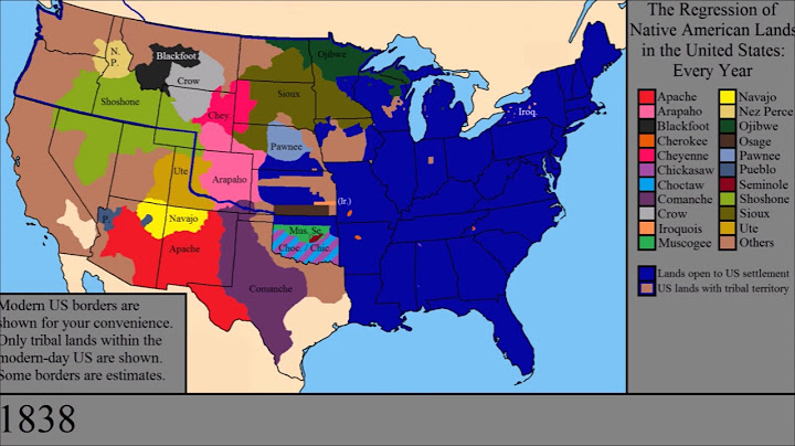
The map is a conversation starter, not a final authority on who has jurisdiction over a property today. It should not be used alone for official land acknowledgment, property disputes, public policy, or legal research.
Territory is not the same as a reservation
Ancestral homelands and traditional territories describe relationships to places that can predate US state boundaries and continue beyond present-day reservations. Reservation and trust land boundaries are legal and administrative matters defined through a different set of documents. Showing an ancestral territory polygon does not imply a current reservation boundary.
For current legal boundaries, use official federal and tribal mapping sources. For historical context, consult the relevant nation's published history and treaty materials.
How to research a location step by step
Identify the place as precisely as possible, then explore the map's territory, language, and treaty layers separately. Note the names you find without treating them as a complete list. Look for the named nations' current websites and cultural resources; check their terminology and any guidance on place-based education or acknowledgement.
If historical records are conflicting, describe the uncertainty instead of selecting a single name only because it appears first on a colored map. Political borders and Indigenous knowledge about land have changed across time.
Why map overlaps are normal
Different nations may have longstanding connections to the same region through residence, trade, seasonal movement, shared stewardship, displacement, or treaties. Boundaries shown on a historical educational map often summarize a complex history into a simplified shape. Overlap is not an error to erase automatically.
When presenting a map to students, ask what its date, data source, and intended use are. A modern administrative boundary answers a different question from a map of languages or ancestral homelands.
Legal and educational limitations
Native Land Digital explicitly states that its map does not represent official or legal boundaries. It is a living project, and contributors may submit corrections. Before publishing a screenshot, check terms of use, required credit, accessibility, and how often the underlying information is updated.
If a reader needs a nationwide map of reservations or a Navajo Nation administrative map, use the dedicated official-boundaries guides rather than treating those products as interchangeable.
Frequently asked questions
Is Native Land Digital a legal map?
No. Its own disclaimer says it does not represent official or legal Indigenous boundaries.
Can I use it to identify the tribe of my property?
It may suggest nations to research, but it cannot establish legal jurisdiction or prove an exclusive relationship to a parcel.
Why are territories overlapping?
Historical and contemporary land relationships are complex and may overlap across people, periods, and forms of use.
Where should I verify reservation boundaries?
Consult official tribal and government mapping resources, not an educational territory map alone.
Related reading
Explore these focused guides for the next step in your research: