US Indian Reservations Map: Modern Boundaries Explained
Find authoritative resources for US reservation boundaries, how they differ from Indigenous homelands, and what a current map can and cannot show.
US Indian Reservations Map: Modern Boundaries Explained
A United States Indian reservations map shows current legal and administrative land areas associated with tribal nations, but there is no single map that answers every question about sovereignty, trust land, jurisdiction, ancestral territory, or tribal citizenship. The best source depends on whether you need a general orientation map or a legally meaningful boundary for a specific location.
What a reservation map can tell you
A nationwide map may show reservations, land held in trust, or other census and administrative areas. These categories are related but not identical. A reservation's boundaries may cross counties or state lines, and the map may not illustrate every parcel of associated trust land. Some federally recognized tribes do not have a large contiguous reservation, so the absence of a polygon does not mean a nation has ceased to exist.
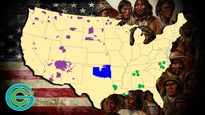
Map legends and dates matter. A map showing statistical boundaries is not automatically reliable for a land transaction or a jurisdictional decision.
Official US mapping sources to compare
The Bureau of Indian Affairs publishes a Tribal Leaders Directory and mapping resources for federally recognized tribal governments. The US Census Bureau publishes geographic products involving American Indian, Alaska Native, and Native Hawaiian areas, with explanations of statistical definitions. Tribal governments may publish their own administrative maps, land offices, or GIS portals.
Use official tribal government sources for questions about a specific nation's governance or land programs, and seek qualified legal advice if a boundary has legal consequences.
Why reservations and ancestral territories differ
Tribal homelands often extend well beyond current reservation boundaries, and historical events such as treaties, relocation, allotment, and legislation changed the legal geography. An ancestral territory map is concerned with historical and cultural connection; a reservation map generally answers a contemporary legal or administrative question.
Native Land Digital is useful for exploring historical territorial context but explicitly disclaims legal-boundary authority. Do not trace its colored shapes and label them current reservations.
Finding a state, county, or community
Start with a current map showing states and counties, then look for the tribal government and official land area you want to locate. Write down the legal name, relevant state or states, data year, and mapping authority. If the area crosses a state border, avoid treating the state line as a tribal boundary.
For accessible publication, accompany any map image with a text description, explain the legend, and include the update date. An article without an actual map image should be labeled a map-reading guide rather than implying it contains a complete current visual atlas.
What a map does not establish
A reservation map alone does not determine a person's citizenship, whether a specific road is public, who owns private parcels, or which court has jurisdiction over an incident. These questions involve records and legal rules beyond a simple outline. Tribal governments are living sovereign institutions, not just shapes on a map.
For a particular Navajo Nation location, see the separate Navajo reservation map guide, which focuses on that nation's tri-state geography.
Frequently asked questions
How many reservations are there in the United States?
Counts vary with the definition and the date of the dataset; use a named official source rather than a detached headline number.
Are all federally recognized tribes on reservations?
No. Tribal land arrangements and recognition histories differ widely.
Can one reservation cross state lines?
Yes. Some tribal land areas extend across multiple states.
Is the Native Land map a reservation-boundary map?
No. It is an educational territory and language resource, not a legal reservation atlas.
Related reading
Explore these focused guides for the next step in your research:
Native Land Map: Traditional Territories and How to Read It