Arizona Flash Flooding: Why It Happens, Warning Types and Safety
Learn why Arizona flash flooding develops quickly, how washes and burn scars increase danger, what NWS flood alerts mean and how to stay safe.
Arizona Flash Flooding: Why It Happens, Warning Types and Safety
Arizona flash flooding is a rapid rise of water in washes, streams, canyons or developed areas after intense rainfall or runoff from higher ground. The dangerous part is the speed: a dry wash can carry fast-moving water even when the sky above you is clear. This guide explains the causes, warning terminology and sensible precautions. It is general safety information, not a live storm bulletin.
Arizona's dry landscape can make flooding seem counterintuitive. Desert soil, steep slopes and cities built near seasonal drainage channels can move water quickly toward places that looked harmless moments earlier. Understanding where the water comes from is more useful than judging risk by how rainy your own street appears.
Why flash floods develop so quickly in Arizona
A thunderstorm may release a great deal of rain over a relatively small area. When water lands faster than the ground can absorb it, runoff begins flowing downhill. As drainage channels join, a shallow stream can develop into a deeper, faster flood. The process is influenced by the amount and intensity of rain, slope, soil moisture, rock surfaces, vegetation and the size and shape of the watershed.
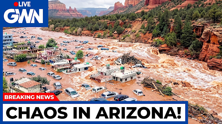
Not every desert surface is equally impermeable. Some sandy areas absorb water well under certain conditions, whereas compacted ground, exposed rock, crusted soils and pavement can shed water rapidly. A storm following earlier rain can be especially dangerous because more of the new rainfall may become runoff instead of soaking into the ground.
Flash flooding is also different from a slow rise in a major river. Flash floods often have short warning lead times and can carry sediment, debris and rocks. A wash that is dry most of the year can still be an active drainage route during storms.
Dry washes, canyons and low-water crossings
A wash is a channel through which stormwater can run, even if it usually contains no visible water. Its absence of year-round flow is not evidence that it is safe during storms. In a canyon or narrow drainage channel, water has limited space to spread out, so conditions can deteriorate rapidly.
Low-water crossings are another Arizona-specific hazard. Some roads intentionally cross channels near streambed level; during runoff, water flows across the pavement. Even experienced local drivers may underestimate the velocity or discover that erosion has damaged the road beneath the water. A barricade is not a challenge to pass; it marks a location authorities consider unsafe.
Floodwaters may contain branches, unstable soil, sharp debris or contamination. Never walk into moving water to retrieve belongings, take photos or gauge its depth. Get to higher ground without crossing a flooded channel and follow instructions from local emergency services.
Burn scars make some storms more hazardous
After a wildfire, vegetation and ground cover may be reduced and water can flow downhill with more sediment and debris. Depending on the soil and severity of the fire, a burned watershed can respond rapidly to heavy rain. That raises the risk of debris flows: water carrying soil, rocks and vegetation down steep terrain.
This is why a burn-scar flash flood warning deserves special attention even when the rainfall amount sounds modest. An NWS Phoenix warning issued at 8:01 p.m. MST on November 1, 2026, for the Sand Stone burn scar in Maricopa County specifically discussed a debris-flow threat. That is a historical example of the mechanism, not a claim that the warning remains in effect today.
People hiking or camping downstream of burn scars should check official weather and incident guidance before a trip. Terrain that looked familiar before a fire may behave differently afterward.
Why it can flood when it is not raining where you are
Imagine a storm over hills upstream while a trailhead remains sunny. Runoff from the hills collects in tributaries, then travels along a wash toward the trailhead. The traveler may see no local rainfall before a surge arrives. This is why forecasts and warnings covering the entire watershed matter, rather than only the forecast for a campsite or parking lot.
A parallel risk exists in developed neighborhoods. Storm drains, culverts and channels move water away from one area toward another. When flow exceeds a structure's capacity, water may pond on streets or enter low places. Local construction, blockage by debris and land elevation can all affect the location and severity of flooding.
Flood watch, advisory and warning: the essential difference
| NWS product | Meaning | Appropriate response |
| Flood Watch | Conditions are favorable for flooding | Prepare, monitor alerts and reconsider flood-prone plans |
| Flood Advisory | Flooding may cause inconvenience or localized hazards below warning criteria | Be alert to low spots and do not enter water-covered roads |
| Flood Warning | Flooding is occurring or imminent | Take protective action and avoid affected areas |
| Flash Flood Warning | Dangerous rapid flooding is occurring or imminent | Move away from flood-prone ground promptly and follow official instructions |
The terms come from the National Weather Service. Each alert has a geographic boundary, issue time and expiration or cancellation information. Do not treat a screenshot of yesterday's warning as today's live status, and do not conclude that the lack of an alert guarantees safety on every minor road.
What to do when a flash flood threatens
Before rain arrives: Identify whether a route crosses a wash, and find alternate roads. Enable weather alerts on your phone. If you are visiting a canyon, creek or remote trail, check upstream forecasts as well as the immediate destination. Tell someone your travel plan, and carry water, a charged phone and a way to navigate if your normal route becomes inaccessible.
When a warning is issued: Leave channels, low ground and flood-prone crossings as directed by authorities. Seek higher ground by a safe route. Do not walk or drive through moving water. Follow emergency instructions rather than waiting for visual confirmation that the water is deep enough to be dangerous.
If driving: Turn around at water over a roadway. The NWS's safety message is simple: do not drive through flooded roads. Darkness, muddy water and debris can conceal washouts. If a road has a gate or barricade, respect it. For state highway alerts consult Arizona 511; local street status may require a city or county transportation source.
Afterward: Look for damage to shoulders, culverts and approaches to bridges. Avoid contact with floodwater and do not approach downed power lines. Never assume a wash is safe because the last visible rain cell has moved away.
Guidance for hikers, campers and visitors
Flash flooding deserves special consideration in slot canyons, narrow ravines and washes without easy exit routes. Check weather across the upstream catchment, not only the trailhead. Avoid camping in the bed of a dry wash. If a flood watch or storm threat overlaps your planned activity, choose higher, safer terrain or postpone the outing.
Visitors sometimes underestimate the threat because conditions feel warm and sunny. Arizona's combination of rugged drainage basins and localized storms means a dangerous flood can arrive from outside the immediate view. Local park guidance and NWS warnings are more dependable than assumptions based on seasonal averages.
Where to look for authoritative information
Use NWS Phoenix or the NWS office serving the area for current watches and warnings. Use county flood control resources for local stream and rain gauges; remember that gauge readings are provisional measurements, not guarantees that a crossing is safe. Use Arizona 511 for state highway restrictions. If you want the specific November 1–2, 2026 news chronology, see Arizona flooding updates rather than treating this evergreen guide as a live report.
Urban readers may also find flooding in Phoenix helpful for the city's drainage and road concerns. The safety principle is the same across Arizona: the most dangerous water may be in a channel you did not see filling.
Frequently asked questions
Can a flash flood happen in Arizona without nearby rain?
Yes. Rain upstream can run into a dry wash and travel toward a place under clear skies. Check watershed-wide forecasts and warnings, especially near canyon and wash crossings.
What is the difference between a flood watch and a flash flood warning?
A watch means conditions favor flooding; a flash flood warning means dangerous rapid flooding is imminent or happening. A warning calls for immediate protective action in the warned area.
Are desert washes safe to cross when water looks shallow?
No. Water velocity, hidden debris and a damaged roadbed can make a shallow-looking crossing dangerous. Never drive or walk through flowing floodwater.
Why are wildfire burn scars vulnerable?
Loss of vegetation and altered soils can accelerate runoff and carry sediment and debris downhill. A burn-scar area may need special attention during intense rain.
Where should I check active Arizona flood alerts?
Use the National Weather Service for current watches and warnings and local emergency services for urgent instructions. Arizona 511 covers state highway impacts; county resources provide supplemental local observations.