Flooding in Phoenix: November 2026 Warnings and Local Impacts
A Phoenix-focused overview of November 2026 flooding, Maricopa County warnings, washes and low-water crossings, with links to official status sources.
Flooding in Phoenix: November 2026 Warnings and Local Impacts
Local source snapshot: NWS Phoenix bulletins from October 30–November 1, 2026, and the Flood Control District of Maricopa County outlook posted at 9:45 a.m. MST on November 1. The information below documents the storm and explains how to find local status. It does not update automatically and does not mean an old warning is still active.
Flooding in Phoenix is not always a matter of a river overflowing its banks. Heavy rain can fill washes, send water across low roadways and overwhelm drainage at individual intersections. During the late October and early November 2026 storm sequence, official NWS warnings and county observations highlighted these exact concerns across parts of the metropolitan area and surrounding Maricopa County.
Phoenix and Maricopa County: what officials reported
At 7:50 p.m. MST on Friday, October 30, NWS Phoenix issued a flash flood warning for a portion of Maricopa County after local law enforcement reported multiple water rescues in the warned area. The bulletin named Phoenix, Paradise Valley, Piestewa Peak Park, Camelback Mountain and the Arizona State Fairgrounds among locations in the warning coverage. It expired that evening, so it is evidence of October 30 conditions, not a new November 2 event or a current closure map.
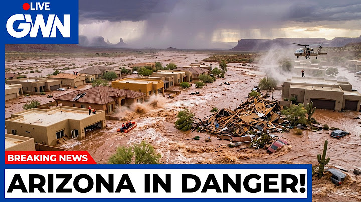
On November 1 at 8:14 a.m. MST, the weather service issued a flash flood warning covering portions of Maricopa and Gila counties, scheduled until 11:15 a.m. Another warning at 8:12 a.m. covered parts of Maricopa and Pinal counties. The warnings were based on radar and, in some cases, automated gauges. They should be read by their geographic polygons, not interpreted as a declaration that every Phoenix neighborhood flooded.
The county's November 1, 9:45 a.m. weather outlook reported widespread new precipitation of around 0.75–1.50 inches since Saturday evening, with locally higher amounts in foothills and elevated terrain north and east of the metro area. The outlook identified rising flows in Indian Bend Wash, Skunk Creek and the Arizona Canal Diversion Channel (ACDC). These are named waterways and drainage facilities relevant to the metro region; naming them does not mean that every access point on them was flooded or closed.
Why Phoenix roads are vulnerable in heavy rain
Low-water crossings: The region includes roadways that pass through or near drainage channels. They may be passable in dry conditions but hazardous when water rises. A low crossing can be affected even if rain has stopped at the crossing itself.
Depressed intersections and underpasses: Urban streets sometimes sit below nearby ground or need drains to move runoff away. Heavy rain can temporarily exceed drainage capacity, and muddy water can hide debris or pavement damage. An ordinary-looking dip in the road can become a dangerous barrier.
Upstream runoff: Phoenix is connected to a broader watershed network. Rain that falls in higher terrain can continue moving downstream after a storm passes the city. This is one reason county officials warned that flows at larger washes might continue into early Monday during the November 1 forecast period.
Repeated rainfall: The county's outlook said the later rainfall fell on soil already wet from an earlier storm. Where ground can absorb less, more runoff reaches streets and channels. However, that process varies by location; one reported rain total does not reveal a neighborhood's actual risk.
A local guide to the key information sources
| Information needed | Appropriate source | Important limitation |
| Active flood warning near an address | National Weather Service Phoenix | The warning covers a defined area and has an issue/expiry time |
| Stream or wash gauge level | Maricopa County Flood Control ALERT system | Preliminary observations cannot by themselves certify road safety |
| County roadway flooding | Maricopa County roadway/flood status resources | Coverage varies by road agency and can change quickly |
| State highway closure | Arizona 511 | A closure bulletin must be read with its last-update time |
| Neighborhood emergency instructions | Local emergency management/public safety | Emergency directions override a general-purpose article |
The difference between these sources matters. NWS warnings describe weather hazards; rainfall and stream gauges report measurements; transportation agencies determine whether a particular managed road is open. A radar screen cannot substitute for an official street closure notice.
What about Phoenix-area road closures?
No reliable, comprehensive Phoenix-city road closure list was available from the particular official bulletins used for this article. They identify dangerous conditions, affected warning areas and channels, but do not support claiming that every mentioned street or highway closed. The October 30 NWS warning's mention of particular state highway mile markers indicates hazard exposure, not necessarily a transportation-agency closure order.
A statewide Arizona 511 notice posted late on November 1 did confirm that flooding forced closures on several state highways, including State Route 238 between Maricopa and Gila Bend. That highway is part of the wider regional travel picture, not proof of a specific Phoenix-city closure. Use the live traveler information system and local road authorities to check an actual route before departing.
For broader impacts beyond the Phoenix area, including northern Arizona highways, read Arizona flooding today: dated statewide coverage. That article deliberately handles the statewide chronology so this local guide can focus on Phoenix and Maricopa County.
When a flash flood warning is relevant to your home
A NWS flash flood warning says fast-moving flooding is imminent or underway in a defined area. Take action if your location is threatened. Move away from washes, arroyos, drainage channels and low-lying roads; follow alerts from the weather service and local emergency management. Do not enter an inundated underpass or drive around a barricade. At night it is harder to see the edge of water and any erosion beneath it.
A flood watch has a different purpose: it tells residents to prepare because flooding is possible. An advisory addresses a lower level of flood impact that still warrants caution. Understanding the different products helps avoid sharing expired screenshots or assuming every mention of a watch describes an active flood at a specific home.
An additional complication is geography. Phoenix mailing addresses, incorporated neighboring cities and unincorporated areas of Maricopa County do not share one road-management system. If your route crosses jurisdictions, check the responsible transportation or emergency agency for each segment.
Rain totals: look for a specific gauge and time window
The county's regional rain ranges are useful context, but readers looking for a precise Phoenix rainfall total need a named gauge and a defined period. A one-hour gauge accumulation and a 24-hour measurement from another station should not be compared as though they were the same observation.
The Flood Control District publishes several views: short-period totals, daily reports and historic data. Values can be updated or corrected after initial reporting. Our companion guide, Phoenix rainfall totals and official gauges, explains how to select an observation period and avoid confusing gauge rain with radar estimates.
What a resident can do before the next storm
Identify alternative roads that do not cross washes, especially for commutes after dark. Sign up for emergency warnings; save the NWS and local road-information sources in your phone; make sure everyone in the household knows not to enter moving water. For hiking and outdoor plans, think about rain upstream as well as rain in central Phoenix.
After a storm, avoid areas with debris, standing water or undermined pavement. Do not cross floodwater to examine damage. Follow local agency notices before entering a previously blocked road. For a more detailed explanation of the science and safety principles, see how Arizona flash flooding works.
Frequently asked questions
Did Phoenix have flash flood warnings in late October and early November 2026?
Yes. NWS Phoenix issued warnings covering parts of Maricopa County during the October 30–November 1 storm sequence. The warnings applied to defined zones and times, not every Phoenix address.
Which Phoenix-area washes were mentioned by county officials?
The November 1 Maricopa County outlook mentioned rising water in Indian Bend Wash, Skunk Creek and the Arizona Canal Diversion Channel. That does not establish the status of every crossing along those channels.
Were all Phoenix roads closed because of flooding?
No such citywide claim is supported by these sources. Road restrictions are location-specific and change; check state, county or city transportation notices for the precise route.
Is it safe to cross a road when the water has stopped rising?
Not necessarily. Water can conceal erosion and debris, and upstream flow may continue. Avoid water-covered roads and respect barricades until the responsible agency reopens the route.
Where can I see Phoenix rainfall totals?
The Flood Control District of Maricopa County provides rain-gauge maps and reports. Select a station and time range rather than relying on a single regional number. See the official rainfall report guide.