Arizona Flooding Today: November 1–2, 2026 Alerts and Reported Impacts
Track reported Arizona flooding from November 1–2, 2026, including regional impacts, official warnings and where to check the latest verified updates.
Arizona Flooding Today: November 1–2, 2026 Alerts and Reported Impacts
Reporting snapshot: This article summarizes official bulletins issued on October 30–November 1, 2026, and road information posted on November 1. All times are Mountain Standard Time (MST), used year-round in most of Arizona. This is a dated report, not a live warning dashboard. Check the National Weather Service (NWS) and Arizona 511 for the status at the time you travel.
A prolonged spell of rain brought flooding concerns to several parts of Arizona over the Halloween weekend. The most concrete evidence comes from NWS Phoenix flash flood warnings, Maricopa County's November 1 weather outlook and an Arizona Department of Transportation travel alert. The official reports describe saturated ground, rising washes and dangerous low-water crossings. They do not establish that every Arizona city experienced flooding, and a warning issued on Sunday should not be presented as still active on Monday without another check.
What the official reports actually confirmed
At 8:14 a.m. MST on Sunday, November 1, NWS Phoenix issued a flash flood warning for parts of Maricopa and Gila counties, with an expiration time of 11:15 a.m. MST in the archived NWS bulletin. Radar and automated rain gauges indicated heavy rain. Another bulletin at 8:12 a.m. covered parts of Maricopa and Pinal counties, also scheduled to expire at 11:15 a.m. These were geographically defined warning areas, not all-county declarations for every community.
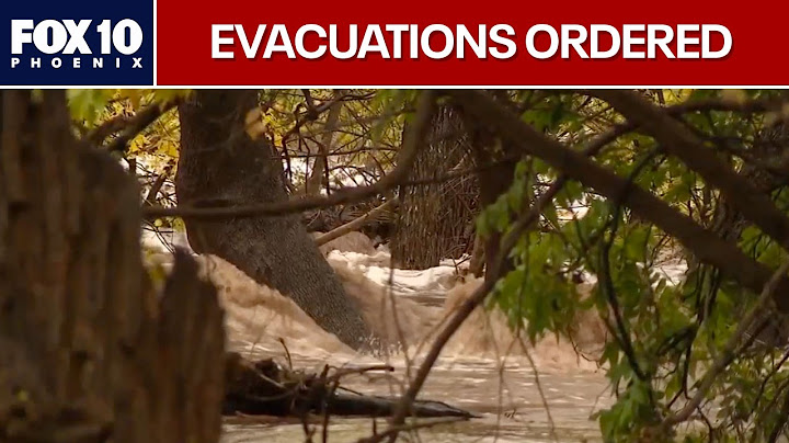
Maricopa County's Flood Control District released an outlook at 9:45 a.m. MST on November 1. It described broadly 0.75–1.50 inches of new rain since Saturday evening, with locally 2.00–3.50 inches or more in some foothill and higher-terrain locations north and east of the metro area. Those numbers are regional estimates from that dated outlook, not a Phoenix-wide daily total. The office said saturated soils were generating efficient runoff and rising water in washes and drainage channels, including Indian Bend Wash and Skunk Creek.
The county's forecast valid through noon MST November 2 also warned that water could persist at some crossings and in larger washes. That forecast period is historical information here; it is not proof of present conditions when this page is read.
Timeline of key dated information
| Date and time (MST) | Confirmed source update | What it means |
| Oct. 30, 7:50 p.m. | NWS warned of flash flooding in part of Maricopa County after law enforcement reported multiple water rescues | A documented earlier phase of the storm; not a Nov. 2 rescue count |
| Nov. 1, 8:12 a.m. | NWS flash flood warning for parts of Maricopa and Pinal counties until 11:15 a.m. | Localized warning based on radar-indicated flooding |
| Nov. 1, 8:14 a.m. | NWS flash flood warning for parts of Maricopa and Gila counties until 11:15 a.m. | Warning area crossed county boundaries |
| Nov. 1, 9:45 a.m. | Maricopa County flood outlook described saturated soils and rising washes | Countywide operational context, not a neighborhood-by-neighborhood gauge map |
| Nov. 1, 9:58 p.m. | Arizona 511 listed multiple highway closures related to flooding | A dated travel alert that can change without notice |
The sequence matters. Reports from different hours, counties and measurements should not be combined into a single claim such as "the entire state received three inches of rain." Where an agency says "possible" or "expected," that is a forecast or warning, not necessarily a later confirmed incident.
Which parts of Arizona were involved?
Maricopa County: The NWS warnings and county flood outlook documented concern around the Phoenix metropolitan area and its wider drainage network. A city address might be dry even when an upstream basin or nearby road crossing is hazardous. For a metro-specific explanation of this distinction, read flooding in Phoenix and local alerts.
Gila and Pinal counties: NWS warning products issued on the morning of November 1 covered specific portions of these counties alongside Maricopa. The county names are a guide to where warning polygons reached, not evidence that every town within those counties flooded.
Northern and central Arizona highways: Arizona 511 posted a November 1 nighttime flood-impact alert naming several roads, including State Route 89A between Sedona and Kachina Village and State Route 238 between Maricopa and Gila Bend. The same update named additional highways around Snowflake, Sedona and Flagstaff. This is evidence of closures as of the alert's timestamp only; it cannot tell a traveler which routes are open later.
What was reported about travel and public safety?
The clearest statewide travel information came from Arizona 511, which warned that flooding had forced closures on some highways and that crews were responding to rockfall in northern Arizona. The travel system did not give a reliable reopening time in that November 1 alert. Before a trip, look up the specific highway or milepost, not a generic phrase like "Arizona roads closed."
In urban areas, runoff can pond at depressed intersections, underpasses and low-water crossings. In rural terrain, a wash may rise quickly because of rainfall several miles upstream. Even when the water looks shallow, its depth, speed and the condition of the pavement beneath it may be impossible to judge. Obey barricades, seek an alternate route and never enter a flooded crossing.
An NWS flash flood warning indicates life-threatening flooding is occurring or imminent within its stated area. A flood watch is different: it means conditions favor flooding but does not guarantee it will occur. This distinction is especially useful when reports from different hours circulate on social media.
How to check the latest verified Arizona flood status
Start with NWS Phoenix for central and southwest Arizona warnings, but check the relevant NWS office if your destination lies in a different region. Search by a specific city or address, inspect the alert polygon and record its issue and expiration times. If no warning appears for one location, that does not mean every road on the route is passable.
Next use Arizona 511, the state's traveler information system, for highway closures and incident notices. For local rain accumulation and streams, check the Flood Control District of Maricopa County rainfall and ALERT products where applicable. Gauge readings may be preliminary and do not by themselves establish a road's safety.
For a deeper explanation of how seemingly ordinary rainfall can become fast-moving runoff, see Arizona flash flooding: causes and safety. For measured precipitation rather than event headlines, use the Phoenix rainfall totals guide.
What remains unconfirmed in this report
This dated summary does not assert a statewide death toll, total number of evacuations, total rescues during November 1–2, a complete list of affected neighborhoods or a current count of blocked roads. One October 30 NWS warning referenced police-reported rescues, but that should not be repackaged as a November 2 figure. Neither countywide rainfall ranges nor radar graphics can identify the precise amount of rain at every home.
If an official agency later releases a storm-event summary, that may resolve some of these questions. Until then, a careful article should keep confirmed observations separate from projections and should not use dramatic images from unrelated storms as if they depict this event.
A practical approach for residents and travelers
If an alert covers your location, prioritize instructions from emergency officials. Keep phones charged, enable wireless emergency alerts and make a route that avoids washes and low spots. If water is rising near a building, move away from the water toward higher ground when it is safe to do so; call emergency services for immediate danger. If driving, choose a paved alternate route rather than testing a crossing or moving a barricade.
After the storm, watch for debris, damaged shoulders and eroded pavement. A route can remain unsafe after rain stops. Conditions in a desert watershed may lag behind the rain because runoff takes time to travel downstream.
Frequently asked questions
Is Arizona still flooding on November 2, 2026?
Official reports confirm flood warnings and impacts on November 1, with some forecasts extending into November 2. This article does not verify active warnings at the moment you read it. Check the current NWS alert map and Arizona 511 before making travel decisions.
Where did the November 1 flash flood warnings apply?
NWS Phoenix issued geographically limited warnings for parts of Maricopa, Gila and Pinal counties on the morning of November 1. Warning boundaries and times matter more than the broad county names alone.
Were Arizona highways closed because of flooding?
Yes. A November 1 Arizona 511 alert listed several closures, including sections of State Route 89A and State Route 238. The posted list is historical and must be checked again for current travel.
How much rain fell in Phoenix?
The county's November 1 outlook gave regional ranges, not one value for the entire city. To report an exact total, select a gauge, a time period and its units. See the Phoenix rain gauge guide.
Why can flooding continue after the rain ends?
Rain from higher or distant terrain can move down washes later, especially when the soil is already wet. A receding storm cloud is not proof that a crossing or channel is safe.