Where Is Morocco? Geography, Borders and Landscapes
Where Is Morocco? Geography, Borders and Landscapes Explore evidence-based facts, context and common misconceptions.
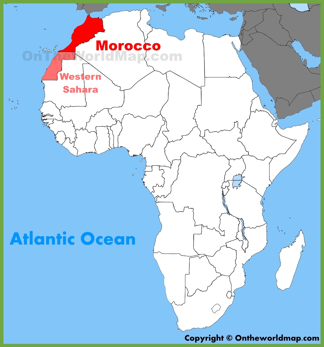
Where Is Morocco? Geography, Borders and Landscapes
Morocco is in northwestern Africa, with Atlantic and Mediterranean coastlines and land borders with Algeria. The country lies across the Strait of Gibraltar from southern Spain, connecting African and European maritime histories.
The essentials
Landscapes range from coastal plains and the Atlas Mountains to arid regions toward the Sahara. Climate, agriculture, and settlement patterns differ substantially across these zones.
What makes this subject distinctive
Morocco is not part of the Middle East geographically; it is a North African country with cultural and historical connections across the Mediterranean, Atlantic, and Sahara. Maps of Western Sahara reflect a disputed political status that should not be flattened into an unqualified boundary claim.
Different maps can emphasize different features: a political border, an oceanic boundary, an ecological zone, or a navigational route. A useful explanation specifies which question the map answers instead of assuming every map must draw the same line.
Common misconceptions and limits
For accurate mapping, distinguish physical location from political territorial disputes, and identify the type and date of the map used.
Geographic terms operate at different scales. A mountain, ocean region, biome, country, and river basin may be shown together on a map, but each follows different conventions. Reliable explanations specify the spatial scale before comparing figures or locations.
Reading the landscape
Physical geography draws on landforms, drainage, climate, ecosystems, and geologic history. A modern place name may refer to a political unit, a broad natural region, or a specific landform, and those boundaries do not always match.
Key points at a glance
Morocco is in northwestern Africa, with Atlantic and Mediterranean coastlines and land borders with Algeria.
Landscapes range from coastal plains and the Atlas Mountains to arid regions toward the Sahara.
Morocco is not part of the Middle East geographically; it is a North African country with cultural and historical connections across the Mediterranean, Atlantic, and Sahara.
Frequently asked questions
What is the key geographic fact?
Morocco is in northwestern Africa, with Atlantic and Mediterranean coastlines and land borders with Algeria.
Why is the setting important?
Landscapes range from coastal plains and the Atlas Mountains to arid regions toward the Sahara.
What definition or measurement needs care?
For accurate mapping, distinguish physical location from political territorial disputes, and identify the type and date of the map used.
Explore related guides
Natural Landmarks and World Geography: Maps, Landscapes and Formation
