Where Is the North Atlantic Ocean? Map and Boundaries
Where Is the North Atlantic Ocean? Map and Boundaries Explore evidence-based facts, context and common misconceptions.
Where Is the North Atlantic Ocean? Map and Boundaries
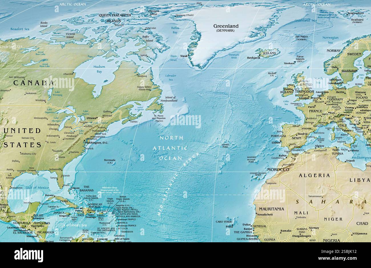
The North Atlantic Ocean is the northern portion of the Atlantic, broadly between North America to the west and Europe and northwestern Africa to the east. Its southern limit depends on the geographic convention used.
The essentials
The region includes major current systems, shipping routes, continental shelves, and ocean basins. Warm surface currents and exchanges with colder northern waters help influence climate around adjacent coasts.
What makes this subject distinctive
North Atlantic is a regional ocean name rather than a separate ocean officially distinct from the Atlantic. Different maps may mark its border with the South Atlantic or Arctic differently.
Different maps can emphasize different features: a political border, an oceanic boundary, an ecological zone, or a navigational route. A useful explanation specifies which question the map answers instead of assuming every map must draw the same line.
Common misconceptions and limits
Maps describing currents, weather, and ecosystems may use slightly different boundaries for scientific reasons. Always check the map legend rather than assuming one universal line divides the ocean.
Geographic terms operate at different scales. A mountain, ocean region, biome, country, and river basin may be shown together on a map, but each follows different conventions. Reliable explanations specify the spatial scale before comparing figures or locations.
Maps require definitions
Different maps can emphasize different features: a political border, an oceanic boundary, an ecological zone, or a navigational route. A useful explanation specifies which question the map answers instead of assuming every map must draw the same line.
Key points at a glance
The North Atlantic Ocean is the northern portion of the Atlantic, broadly between North America to the west and Europe and northwestern Africa to the east.
The region includes major current systems, shipping routes, continental shelves, and ocean basins.
North Atlantic is a regional ocean name rather than a separate ocean officially distinct from the Atlantic.
Frequently asked questions
What is the key geographic fact?
The North Atlantic Ocean is the northern portion of the Atlantic, broadly between North America to the west and Europe and northwestern Africa to the east.
Why is the setting important?
The region includes major current systems, shipping routes, continental shelves, and ocean basins.
What definition or measurement needs care?
Maps describing currents, weather, and ecosystems may use slightly different boundaries for scientific reasons.
Explore related guides
Natural Landmarks and World Geography: Maps, Landscapes and Formation
