Southern Ocean: Location, Boundaries and Wildlife
Southern Ocean: Location, Boundaries and Wildlife Explore evidence-based facts, context and common misconceptions.
Southern Ocean: Location, Boundaries and Wildlife
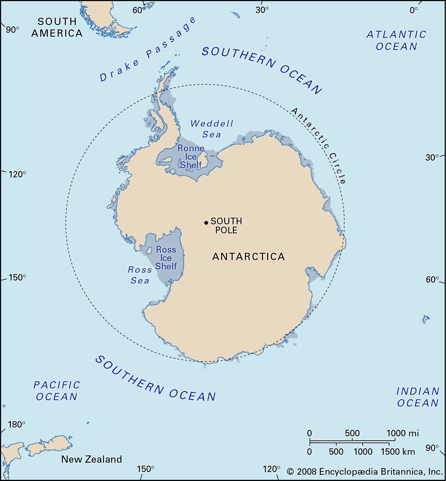
The Southern Ocean surrounds Antarctica and connects the Atlantic, Pacific, and Indian ocean basins through the Antarctic Circumpolar Current. Its waters help redistribute heat, carbon, and nutrients around the planet.
The essentials
Many modern maps use 60 degrees south latitude as a practical northern boundary, although geographic naming conventions and institutional recognition have varied. Sea ice expands and contracts seasonally and influences marine ecosystems.
What makes this subject distinctive
The Southern Ocean should not be confused with the waters of a single Antarctic sea such as the Ross Sea. Its position is defined by large-scale circulation and geography, not simply by one coastline.
A general explanation cannot predict the danger at a specific address. Exposure, building design, terrain, water depth, and current conditions change outcomes. Use local forecasts, hazard maps, and official emergency alerts for decisions that affect personal safety.
Common misconceptions and limits
Changes in ocean temperature, sea ice, and currents have global consequences, but trends require long observation records and should not be inferred from one unusually cold or warm season.
Science explains processes; emergency authorities communicate immediate decisions. If a topic involves public safety, general educational prose must not override local earthquake guidance, weather warnings, evacuation maps, or coastal tsunami instructions.
Understanding the physical process
Earth systems are connected: oceans influence climate, rock processes shape land, and atmospheric conditions govern many weather hazards. The essential scientific distinction is between the physical cause of a phenomenon and the particular impact experienced in one place.
Key points at a glance
The Southern Ocean surrounds Antarctica and connects the Atlantic, Pacific, and Indian ocean basins through the Antarctic Circumpolar Current.
Many modern maps use 60 degrees south latitude as a practical northern boundary, although geographic naming conventions and institutional recognition have varied.
The Southern Ocean should not be confused with the waters of a single Antarctic sea such as the Ross Sea.
Frequently asked questions
What is the basic explanation?
The Southern Ocean surrounds Antarctica and connects the Atlantic, Pacific, and Indian ocean basins through the Antarctic Circumpolar Current.
Why can local conditions change the outcome?
Many modern maps use 60 degrees south latitude as a practical northern boundary, although geographic naming conventions and institutional recognition have varied.
When should official guidance take priority?
Changes in ocean temperature, sea ice, and currents have global consequences, but trends require long observation records and should not be inferred from one unusually cold or warm season.
Explore related guides
Earth Science Explained: Oceans, Weather, Volcanoes and Natural Hazards
